Borough and State: Manhattan, New York
Listed: 1970, extended in 1981
Type of district: National Register historic district, local historic district
Main Streets: West 21st Street and Ninth Avenue
Chelsea LPC Historic District Report
Chelsea LPC Historic District Extension Report
Chelsea LPC Historic District Map
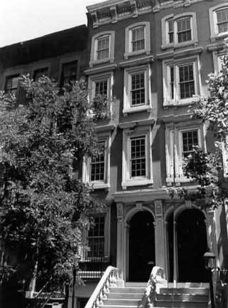
The Chelsea Historic District is located on land that was once the 18th-century Chelsea estate of Captain Thomas Clarke. His descendant, Clement Clarke Moore, planned to divide the estate into parcels for an elegant residential neighborhood. The earliest map of the land division dates to 1835. The houses had to be fireproof, 2 or 3 stories in height depending on their location, as wide as the lot, and have a front yard. Moore’s own estate house was to remain in the neighborhood, but on a smaller parcel of land. Many of the earliest houses are now gone, having been replaced later in the 19th century. In the years immediately preceding the Civil War, the neighborhood was essentially completed with many Greek Revival and Italianate row houses. In the later years of the 19th century, quality multi-family housing was constructed in the district. London Terrace opened in 1930 and was – at the time – one of the world’s largest apartment blocks. The neighborhood never developed into the first-class residential area Moore had envisioned, but it remained a solidly middle-class neighborhood.