City and State: Vineyard Haven, Massachusetts
Listed: 1983
Type of district: National Register historic district, state historic district, local historic district
Main Intersection: William and Church Streets
William Street National Register Historic District Report
William Street National Register Historic District Map
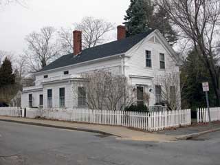
The William Street Historic District includes 56 buildings, mostly residential, located above the Vineyard Haven harbor. Permanent settlement began in Vineyard Haven in 1674. Three planned developments were constructed in the district from the 1830s to the 1850s, including the Thomas Bradley Model Village, the James Cottle-William Downs Partnership, and William Dagget, Jr.’s Benefaction. Most of the houses constructed during this period were done in the Greek Revival style, which was in its heyday. Streets were laid out to accommodate house lots, but also to provide access to the burying ground at the Methodist Meeting House, to which the buyers had rights. Most of the buyers were men of the sea or builders, who could afford to build fine housing suited to their stature. There was minimal building in the latter half of the 19th and early 20th centuries, though what did happen was certainly spurred by the growth of summer tourism on Martha’s Vineyard.